


Waterfall Tours from Brevard, North Carolina
This is a three-hour open-air Jeep waterfall tour. It leaves from Brevard, North Carolina, visits two or three waterfalls inside Pisgah National Forest, and costs $99 for guests ages 13 and up, $59 for children 5 to 12.
- Three hours, round tripDepartures at 9:00 a.m., 12:30 p.m. and 4:00 p.m. through October.
- Departs Brevard, not Asheville209 N. Caldwell Street, Brevard, NC 28712 — about 45 minutes from downtown Asheville.
- $99 guests 13 and up, $59 childrenTwo guests minimum. Private and public departures are both offered.
- Open-air Jeep with a local guideEnclosed and heated configurations are available in cooler months.
- Two to three waterfalls in Pisgah National ForestWhich ones depends on the season and the day’s conditions.
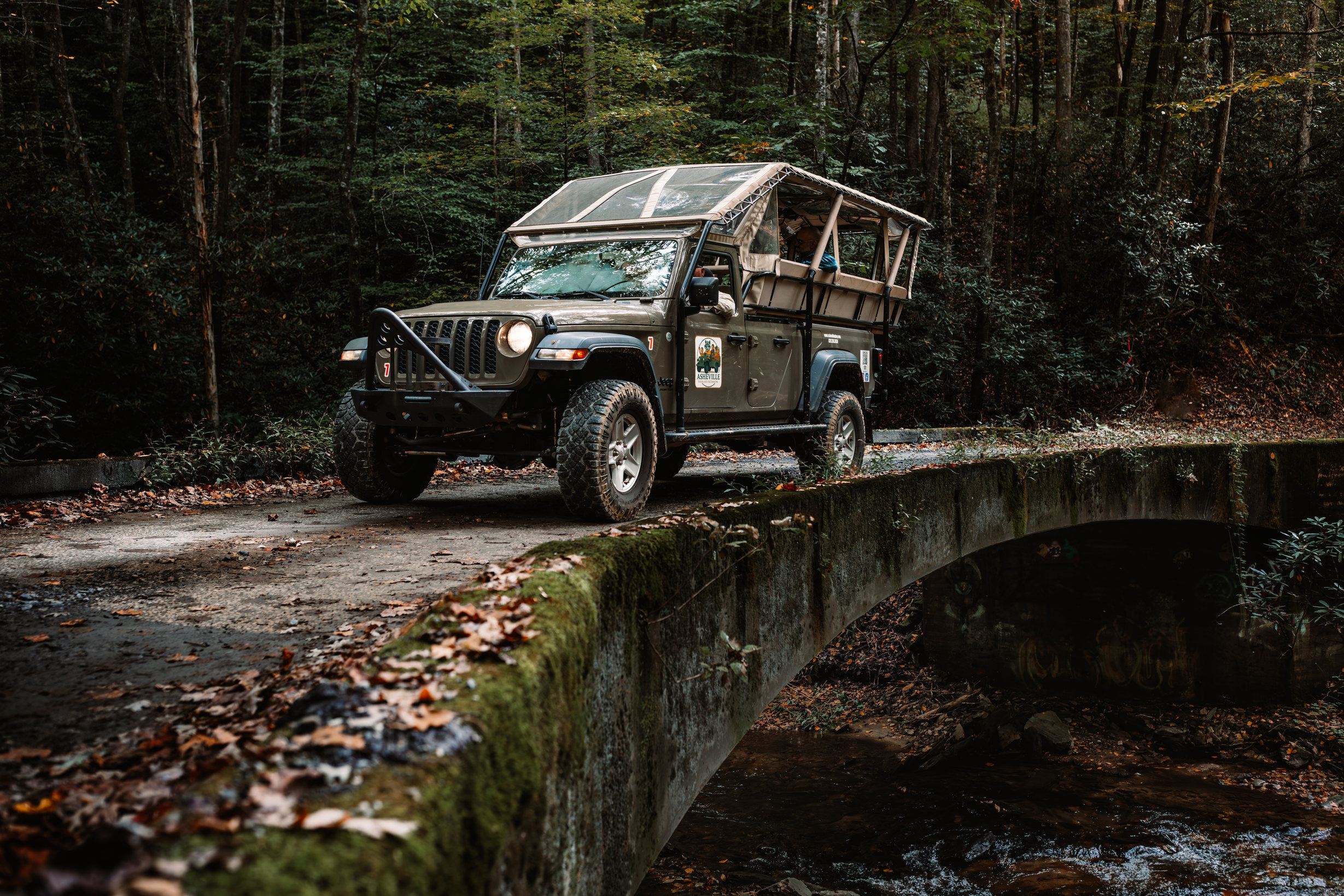

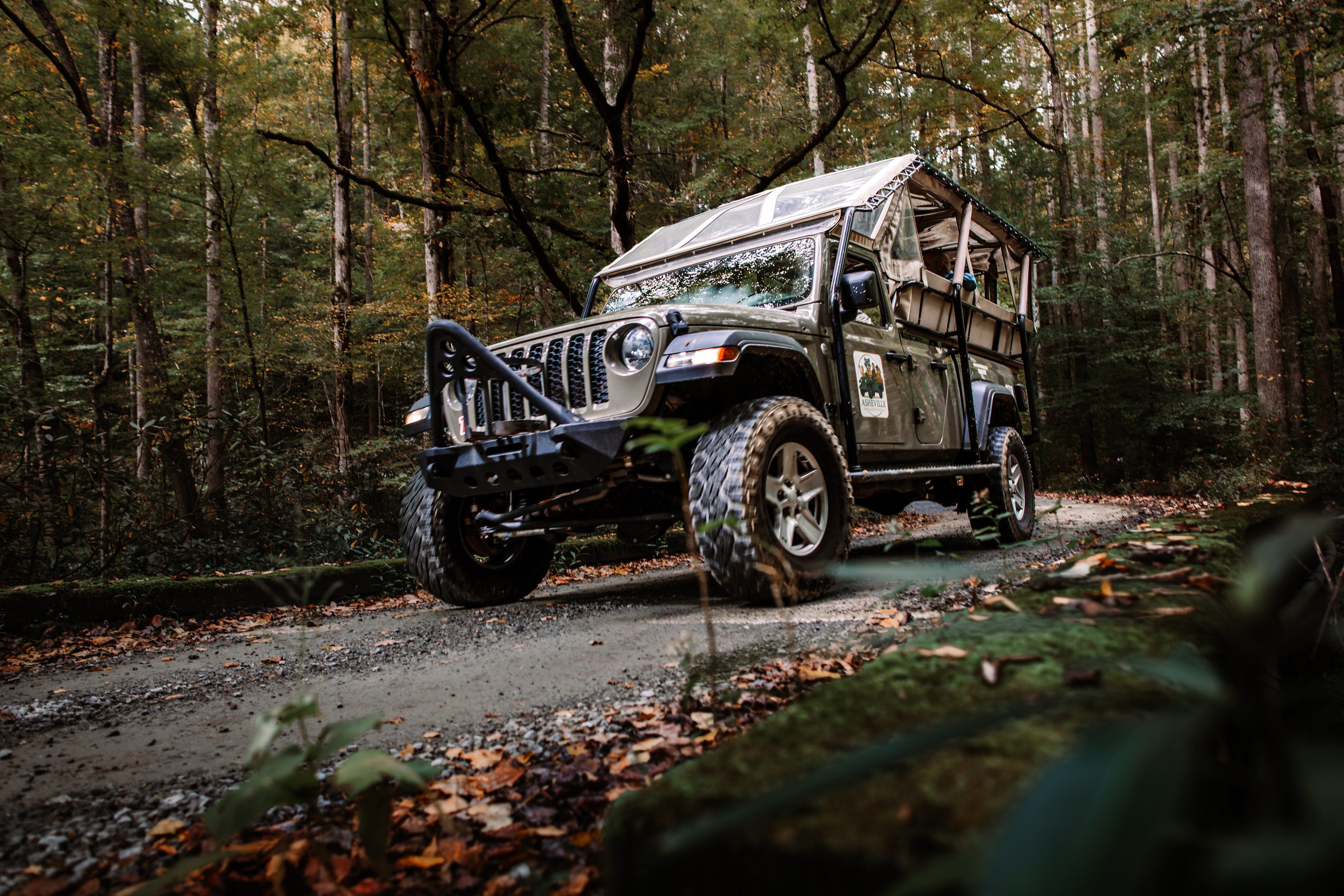
The route climbs north out of town on US 276, past the corridor's best-known falls. Your guide handles the driving and the parking — the part that goes wrong on a summer weekend, when the small lots by the falls fill.
Weighing a half-day van trip near Asheville against something shorter? This is the shorter one: a morning or an afternoon, two guests minimum, in a vehicle small enough for the forest pull-offs.
What you get: three hours, an open-air Jeep, and a guide who knows the forest
Three hours, one guide from these mountains, and two or three waterfalls inside Pisgah National Forest. Blankets and rain ponchos ride with you, and hiking poles are there if you want them.
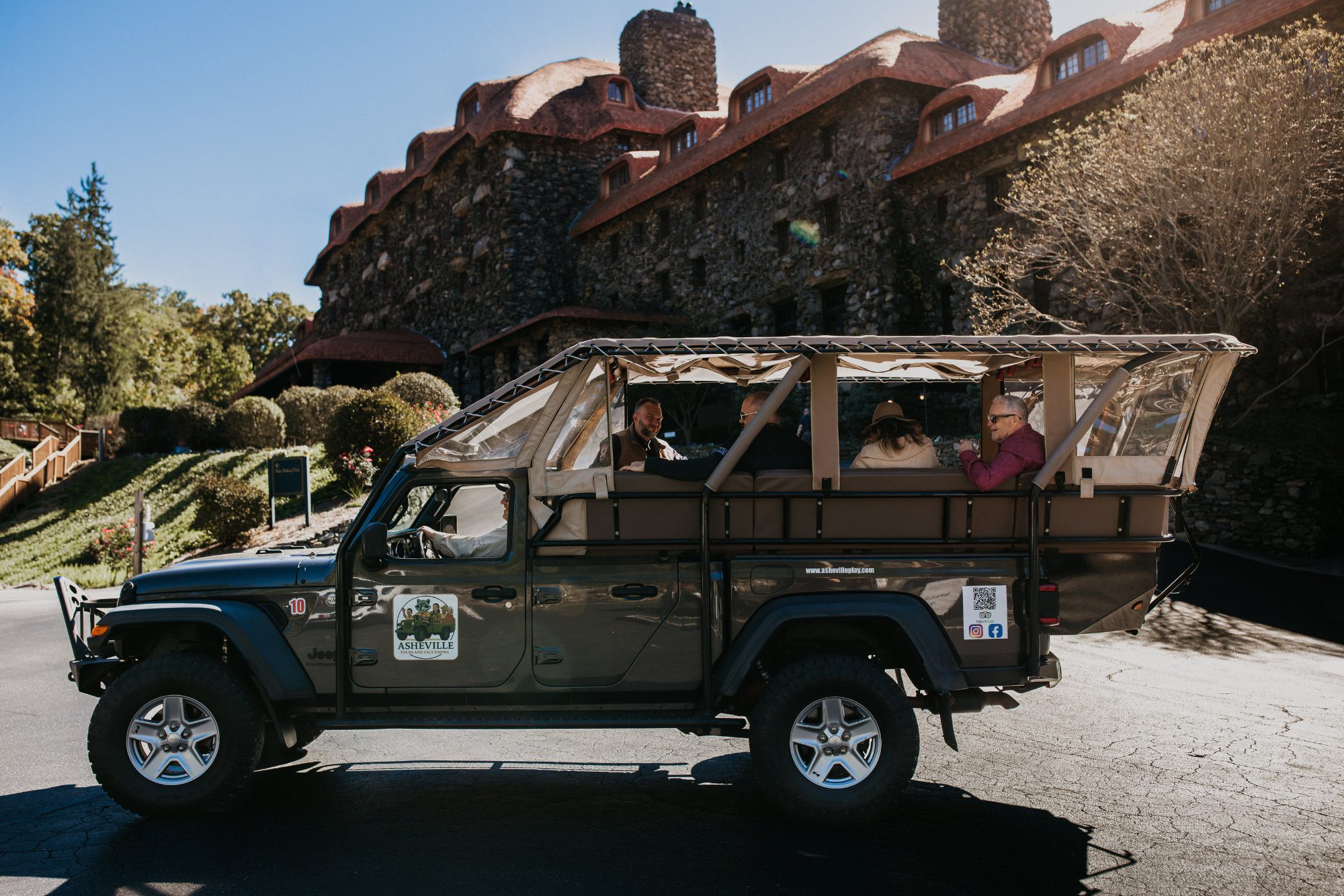
The Jeep, and why open-air changes the drive
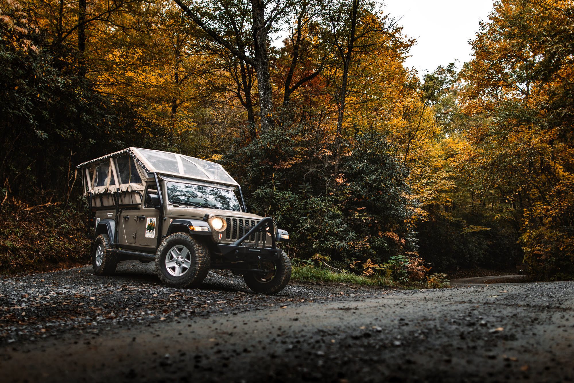
The Jeep is custom-built with elevated seating, and there is no glass between you and the forest. You hear water before anyone points at it. You get cool air off the creeks and the smell of wet rhododendron on the climbs. A car window flattens all of that into scenery.
Quick-release side windows clip in within minutes if the weather turns, and rear heaters handle cold mornings. In the cooler months the Jeeps run enclosed and heated.
Your guide
Your guide is from here and drives the whole route. They talk about Appalachian history and ecology, and the folklore that came out of both. If weather or a road closure changes the plan, they reroute — that call belongs to the guide.
At every stop, stay on the trail and off the rock beside the water. Rock near a waterfall is slick with algae as much as with spray, so dry stone can be as dangerous as wet. A man died climbing the side of a fall on this road, and a second man died the same way at the same fall. People have also been swept over a waterfall after wading in the stream above it. Your guide will tell you where the safe ground ends, and that instruction is not decoration.
Private or public
Public departures share the Jeep with other guests. Private bookings and custom events run through our sales team. Either way, a booking starts at two people.
Which waterfalls you see
We name our stops. Almost nobody selling a waterfall trip on this road does — we can because we drive the same three. Looking Glass Falls is the one you have probably already seen in a photograph. The other two are lesser known, and we go to them for exactly that reason.
The famous falls here are the busy ones. Looking Glass fills its roadside spaces on summer weekends and most days in October; further up the same highway, one recreation area closes its gate the moment the last space goes. Riding to a fall almost nobody has heard of, with a driver who knows where the turn is, is the thing you are actually buying.
Expect two to three stops on the day, drawn from the three below. Living Waters holds two falls at one pull-off, so a good morning can add up to four. Not every departure reaches every stop — water and weather decide — and that flexibility is most of what a guide is for.
Looking Glass Falls
Sixty feet, one unbroken plunge, straight off the highway. You see it from the pull-off. Parking is free and lines the roadside — space, not money, is the constraint. A paved walkway and observation deck sit at road level, and a concrete stair runs down toward the pool. That makes it one of very few waterfalls in this corridor a guest with limited mobility can actually reach — the whole fall is visible from the deck, with no walking at all.
Read this before we stop. One man died here jumping from the top into about six feet of water. Another was badly injured falling from rock beside the falls, and a child was pulled out of rising water at the base during a flash flood. Wet rock and dry-looking rock are both slippery — the algae responsible is almost invisible. Look from the deck and the stair. Every stop on this trip is a looking stop; we don't swim.
Living Waters: French Broad and Cathedral Falls
That is our name for it, after the Bible camp it sits beside. Two waterfalls share one pull-off on NC 215, on the North Fork of the French Broad: French Broad Falls, and Cathedral Falls a short walk downstream. Cathedral answers to a second name, Bird Rock Falls — the same water, and the one a map search is likelier to hand you. A rock bluff overhangs the river above it, and the cliffs around it earned the cathedral name. The trail linking the two passes a couple more cascades nobody has bothered to name.
The land is private. A ministry owns the parcel and lets the public walk in — a courtesy that can be withdrawn. Carry your litter out and keep a dog on a lead. Everybody standing there is a guest, including us.
Slick Rock Falls, the hidden one
Our hidden waterfall, and the stop guests talk about afterwards. It sits off a gravel forest road — one lane where it leaves the pavement, often closed through winter — and there is no car park: a pull-off on a curve, then about a hundred yards on foot up rock steps. It is a low-flow fall that wants rain. After a heavy one it is the best thing on the road; in a dry spell we may spend that time elsewhere.
Slick Rock Falls is not Sliding Rock. Sliding Rock is the natural water slide further along US 276, with an entry fee and lifeguards only through the summer season. Different water, different road, and not a stop on this trip.
Logistics
How long it takes and where it departs
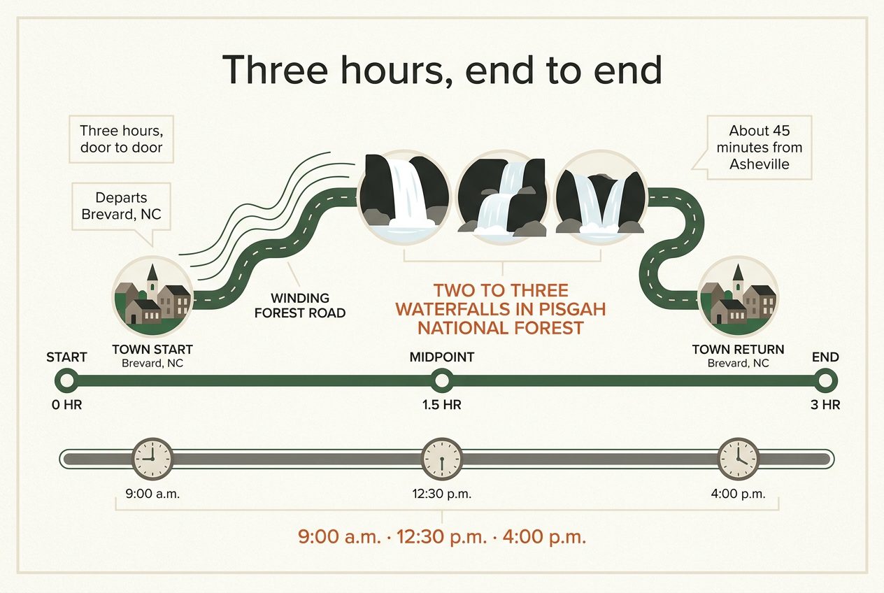
Three hours, start to finish.
You meet your guide at 209 N. Caldwell Street, Brevard, North Carolina 28712 — in Brevard itself, not at an Asheville pickup point. The same operator runs a longer four-hour trip that departs Asheville; that is a separate tour with its own listing.
Getting to Brevard
Brevard sits about 45 minutes from downtown Asheville. If you're staying in the city, build that drive into your morning and arrive a little ahead of your departure time.
That drive is the normal shape of a waterfall trip in this part of the mountains. Most guided outings here meet south of Asheville, in or beside the Brevard and Pisgah corridor, for the straightforward reason that the falls are there. Starting from Brevard means the driving time goes into seeing water rather than into getting close to it.
Departure times
Three departures run each day through the end of October: 9:00 a.m., 12:30 p.m. and 4:00 p.m. From 1 November the 4:00 p.m. departure comes off and the 9:00 a.m. and 12:30 p.m. times remain.
Trips run with a minimum of two guests, and the live calendar closes two hours before each departure. After that, call (828) 269-3936 and ask what is still open.
To see exactly which times are running on your date, check your date on the live calendar. It is the one place that reflects the current schedule, including any day a departure has already filled.
Booking
What it costs and how to book
$99 for guests ages 13 and up, $59 for children ages 5 to 12. No tax is added on top.
Pick your date and departure time, and book it online. A booking is for two guests or more. Online booking closes two hours before departure — if you are running later than that, or you would simply rather sort it out with a person, call (828) 269-3936.
Check availability and book
Cancel with at least 48 hours' notice and you get a full refund or a credit, as long as trip insurance was purchased with the booking. No-shows are charged the full price.
If you want a longer day
There is a four-hour version that pairs the Blue Ridge Parkway with waterfalls, at $119 for guests 13 and up and $69 for children. It leaves Asheville, not Brevard, so make sure you know which town you are driving to before you book it.
Before you go: who it suits, and what to bring
Who tends to book this
This is for people who want to stand in front of these falls without walking two or three miles to reach one. Most guided waterfall trips in this region are hiking trips — two to three miles on foot is the normal ask around here. This one is built around short walks from where the Jeep stops.

Mixed-age groups book it heavily, because a grandparent and a nine-year-old get the same afternoon out of it. So do visitors who would rather not drive unfamiliar mountain roads, and who would rather not spend an hour hunting a space in lots that close as soon as they fill.
It suits someone with one free afternoon and no time to work out which trailhead is worth it. It suits solo travellers who would rather not walk to a remote fall alone. And it suits anyone with a sore knee, a hip or a stroller who had written waterfalls off entirely.
Who it is not for: if you want a long hike, or hours sitting at one fall, a different trip will serve you better.
Booking starts at two guests. If you have a child under five, or a question about the step up into the vehicle, call first rather than guess — (828) 269-3936.
What to bring yourself
Shoes with grip, and this one matters — sandals and flip-flops leave you sliding on wet stone.
Layers. It runs 15 to 20 degrees cooler at elevation than it does in town. Ponchos and blankets ride along, so a passing shower is not a reason to cancel.
Staying safe around the water
People have died at falls in this corridor, and the ways it happens repeat. Two men died at Moore Cove Falls climbing up the side of it. Others have been wading in the creek above a fall, lost their footing and been carried over. Jumping in kills people because plunge pools hide rocks and logs nobody can see from above.
Wet rock is slippery, and rock that looks dry often is too — a film of algae grows on it and is almost invisible.
So: stay on the platforms and the marked path. Do not climb. Do not get into water above a fall. Do not set up a photograph at the top of one.
If something goes wrong out here, help arrives in hours rather than minutes. That is the whole reason these rules are worth keeping.
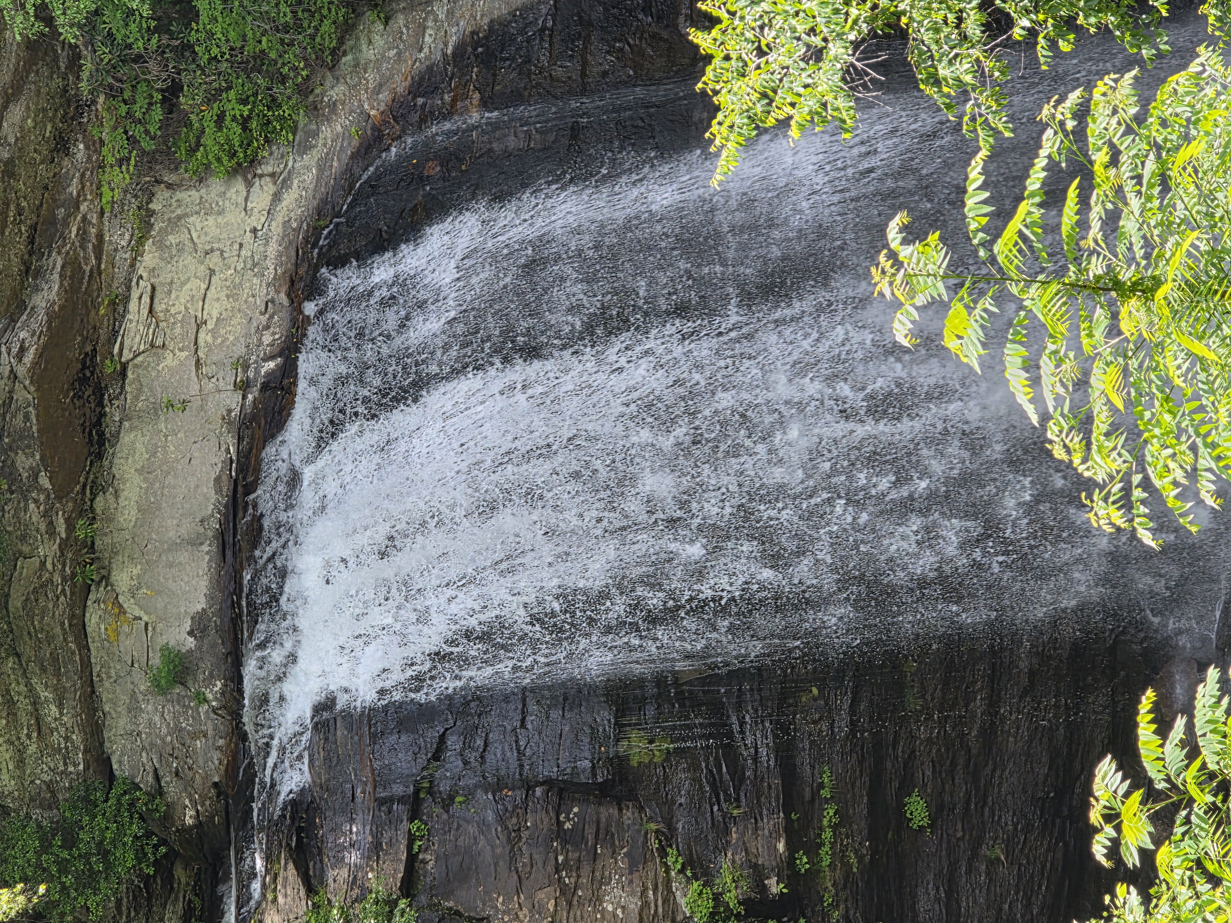
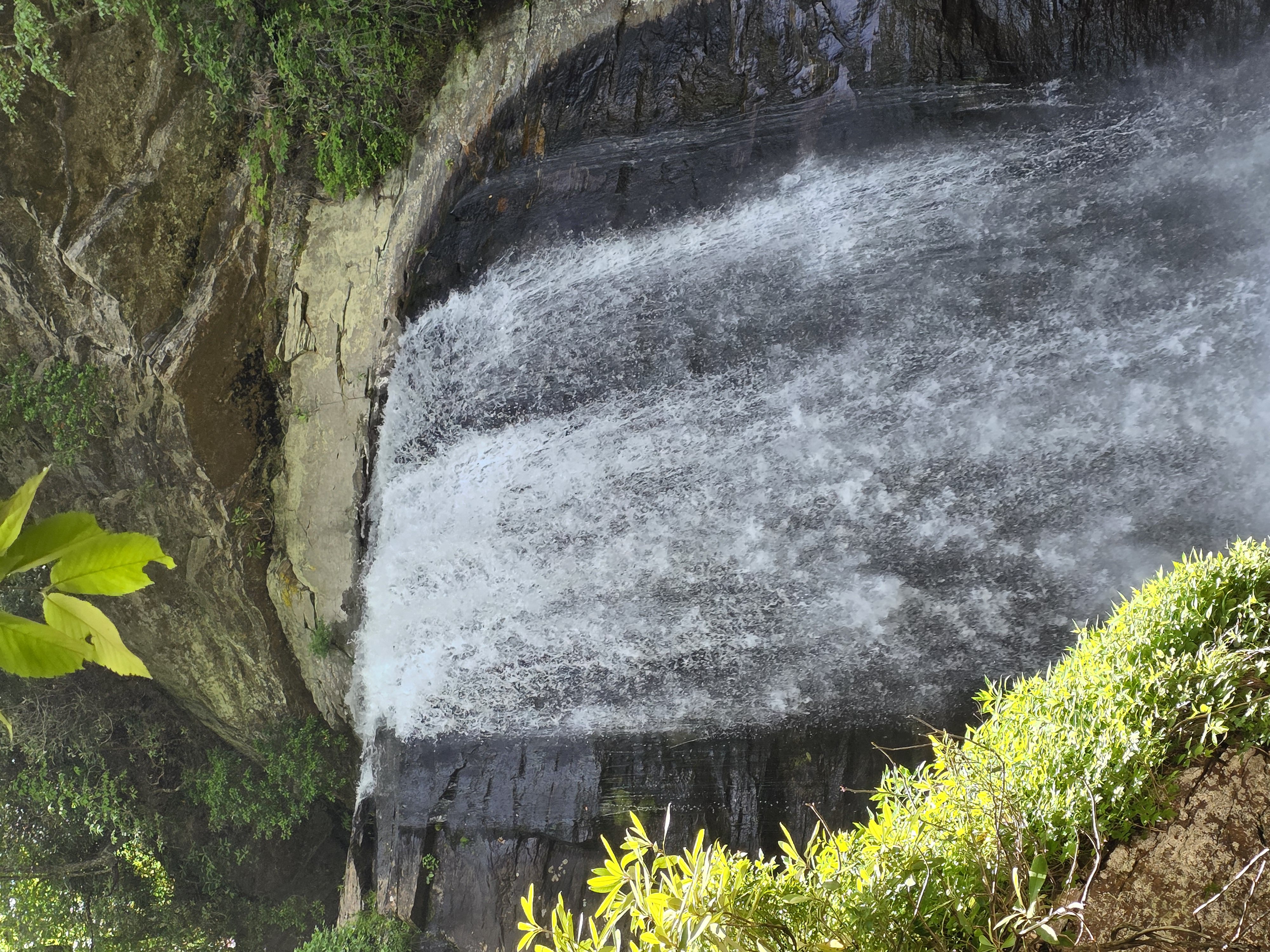
The same water from higher up. How hard it runs is a question of the season.
Are the waterfalls flowing right now?
Water levels move week to week, and no page can promise what a creek will do on the morning you arrive. Here is the pattern this corridor keeps — and what to check the day before you drive.
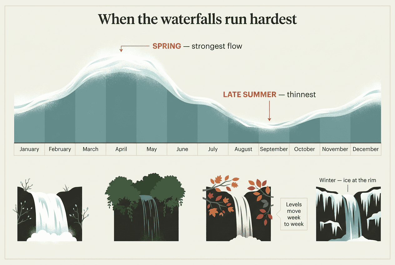
When the water runs hardest
Spring is the peak. April and May rain lands on snowmelt off the high ground, and every creek in the corridor runs at its yearly high — water that thins to a trickle by late summer comes down hard in April.
Late summer and early autumn run leaner, but the air is at its clearest and the long views open up. Winter is the wild card: after leaf drop the rock stands bare, and a hard freeze can set spray into ice at the rim.
The trade-off in a wet season is footing. Trails turn muddy after rain, crossings rise, and steps ice over in the cold.
What a thin week actually looks like
A low week is not a wasted morning. With the creek down you see the architecture — the lip of the ledge, the undercut behind the curtain, the colour of the pool, the stones on its floor. The walking is easier, and a crossing that runs knee-deep in a wet month steps across dry.
Water in full spate is the exact condition in which the rock beside it is most dangerous. The current above a lip runs fast, even well upstream.
People have lost their footing in shallow water above a fall in this region and been carried over it.
Rock near falling water is slick with mist and algae — and algae-covered dry rock is every bit as slippery as wet.
We watch from the deck and the trail. Nobody climbs on a fall, and nobody goes into the water above one.
How to check before you drive
Three things move independently: water level, road status and trail status. A road can be open while a staircase beside a fall stays closed, and a trail can be fine while half its parking area is fenced off for construction work.
Check the live pages the day before you set out — they are updated far more often than any tour page can be. Closures and alerts for Pisgah National Forest sit on the forest alerts and closures page, and if your trip takes you up onto the Blue Ridge Parkway, the Parkway road status page carries a time stamp on every section.
The last piece is the one a self-driver cannot buy. When a fall is thin, or its steps are shut, or its lot is full — and the corridor's best-known roadside fall is lucky to have an empty space on a summer weekend or any day in October — we drive to another one. A guide on this road most days knows which water is running, and turns the Jeep that way.
The best waterfalls near Asheville
The falls worth a morning sit in two clusters south of the city: the US 276 corridor running north out of Brevard through Pisgah National Forest, and DuPont State Recreational Forest to the east. Looking Glass Falls is roughly 45 minutes and 35 miles from Asheville; the DuPont falls are about the same. What separates them is how far you walk and how early the car park fills.
Never climb on a waterfall, and never wade in the water above one. Two men have died at Moore Cove Falls climbing up the side and across the top. Above a drop the current runs faster than it looks, and the rock is coated in algae you cannot see.
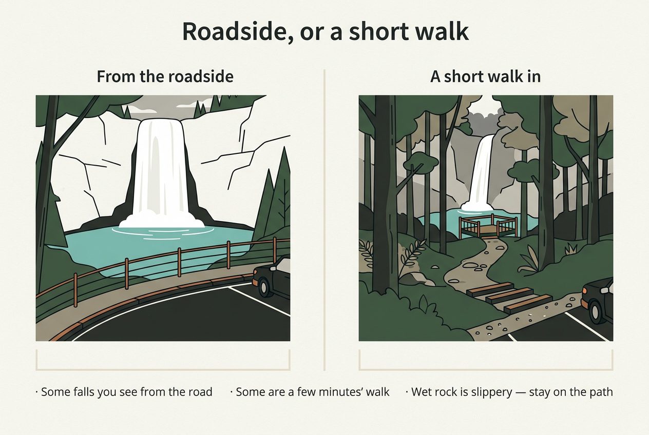
Falls you can see from the road
Looking Glass Falls drops 60 feet in a single sheer plunge, and you see it from the road, with a paved walkway for viewing at street level. Wooden steps lead down to the boulders at the base. There are no restrooms and no drinking water, and parking is a limited strip beside the highway, full on summer weekends and any day of the week in October.
Sliding Rock, further up the same road, is a natural water slide. Its car park closes outright when it fills, and waiting on the highway is not allowed. Entry is $6 a person, free for ages five and under. Nobody who cannot swim may slide, and there are no lifeguards outside the Memorial Day to Labor Day season.
Falls a few minutes' walk from the car
Moore Cove Falls is a mile north of Looking Glass and the best short walk in the corridor: 0.7 miles, rated easy, steep only for the first stretch, with footbridges over the creek, ending at a viewing platform beneath a 50-foot drop off a cave-like ledge. There is no sign on the highway, just an information board by the parking area. Going behind the falling water is a bad idea; the wet rock there is slippery and dangerous.
In DuPont, Hooker Falls is 0.4 miles from its own car park, twelve feet high and river-wide, with restrooms and changing rooms at the parking lot. High Falls is half a mile from the visitor center and slides down a long plane of granite; Triple Falls sits between them on the same trails, though the stairs to the closer view are shut — check the closure list before you drive. Those lots are often completely full by 9:30 a.m. in summer, and weekends are busy all year. Entry and parking are free.
How far the good ones actually are
From Asheville you drive south on NC 280 toward Brevard, then north on US 276 into the forest: Looking Glass is 5.65 miles up from that junction, Moore Cove a mile beyond it. DuPont is the same drive by a different road, NC 280 for 16 miles then US 64 east for four.
Higher up, the Parkway reaches Graveyard Fields at milepost 418.8, 37 miles from town, where Second Falls is a third of a mile from the trailhead. Parking is the hard part: signs mark where you may and may not stop, and cars that ignored them have rolled down the embankment.
Two famous names are missing on purpose. Crabtree Falls sits inside a closed stretch of Parkway where recreation of any kind is prohibited, and Linville Falls is 66 miles north with the direct Parkway route severed. Before any drive up there, read the live road status.
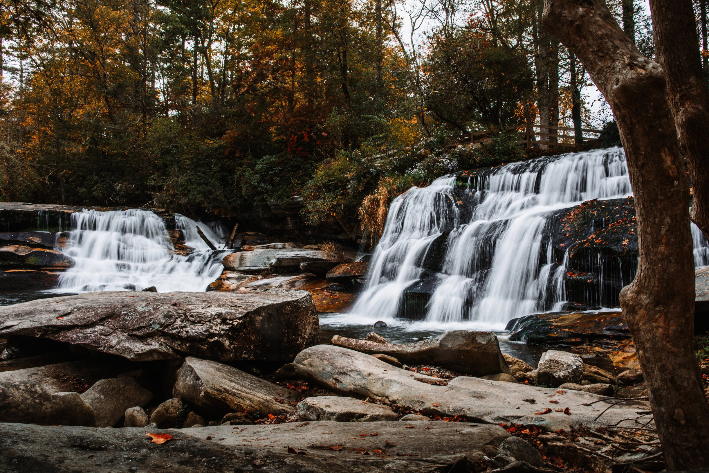
Autumn in the corridor, shot from the boulder field at the base.
Timing
Best time of year to see them
Every season gives you a different waterfall. What moves is how much water is coming over, and how many cars are ahead of you at the pull-off.
Whatever month you come, the water is the hazard. Stay out of the stream above any waterfall — the current there runs faster than it looks, and people have been swept over the lip and killed. Algae makes dry rock as slick as wet rock, so footing near the water is never as good as it appears.
Spring
Spring carries the strongest water of the year. Rain and melt off the high ground push every creek to its peak — a fall that is a thin ribbon in late August comes over hard in April.
The trade-off is underfoot: wet ground, high creek crossings, and the trails at their muddiest.
Summer
Deep green, and cool under the canopy while town bakes — the hills can run 15 to 20 degrees cooler than the city. The water thins as the season goes on, so late summer shows you the least of it.
Summer is also the crowding. Car parks across this area fill by mid-morning, and the one managed swimming area on this road shuts its lot the moment it fills, reopening only as spaces free up. Knowing which pull-off is turning cars away is worth more in July than in any other month.
Autumn
Autumn brings the cleanest air and the longest views of the year, with colour through the hardwoods on the drive between stops.
It also brings the heaviest traffic of the year. October is the busiest month out here, and the pull-offs fill on weekdays as well as weekends. Some operators stop running waterfall trips for the month entirely.
Winter
With the leaves off you see the full drop and the shape of the rock behind it, rather than a gap in the canopy. In a hard cold snap, ice builds at the rim.
Winter is the season to check before you set out. The high road closes for snow and ice, and forest roads can close with it. Live road status and forest alerts are the two things to read that morning.
Three departures a day run through the end of October: 9:00 a.m., 12:30 p.m. and 4:00 p.m. From 1 November there are two, at 9:00 a.m. and 12:30 p.m. The booking calendar shows what is running on your date.
Waterfalls of the Pisgah corridor
Transylvania County counts 250 waterfalls and has taken the Land of Waterfalls as its name. The highway running north out of Brevard threads past a run of them, and that density is what makes this stretch of Pisgah National Forest unusual — not one famous drop, but several within a few miles of one another.
One sits a mile up the same road from the next. Several are visible straight from the pavement, with a paved walkway and a viewing deck built at the roadside. Others ask for a walk instead: seven-tenths of a mile on an easy graded trail, over footbridges, to a platform at the base.
The shapes vary more than the distances do. There is a sheer sixty-foot plunge into a pool, and a fifty-foot fall spilling over a cave-like rock outcrop further up the same creek system. Some sit at 2,360 feet, close enough to hear from a parked car; others are 5,000 feet up in the same forest, where the water runs through open high country.
Volume moves with the season. Snowmelt and spring rain push these creeks to their fullest, and the same falls thin through late summer. It is worth reading the current forest conditions before you drive up.
The pictures below are from this corridor rather than from a fixed list of stops. Which falls a given morning reaches comes down to the guide's read of water levels, road work and how full the small pull-offs already are.
A photograph flattens all of it. Never climb on a waterfall, and never step into the water above one. The rock stays slick from mist and algae even where it looks dry, and two men have died climbing beside one of the falls on this road.
Questions
Common questions
How much does it cost, and what is included?
$99 for anyone 13 and over, $59 for children 5 to 12, on a three-hour tour with a two-guest minimum. Your guide and the driving are covered, along with blankets and rain ponchos; hiking poles are there if you want them. Gratuities are not included.
How much walking is there, and can I do this if I cannot hike far?
Not much. The falls on this route sit close to where we park, so you are on your feet for minutes, and one of them you see from the roadside. Wet rock is the real hazard here: stay on the path and the viewing deck, and never climb on the rock beside a fall. Call (828) 269-3936 with any access question.
Where does the tour leave from, and do you pick up at my hotel?
From 209 N. Caldwell Street, Brevard, NC 28712. We do not pick up at hotels. Many readers assume pickup comes standard with a tour like this, so plan to drive yourself to that address and meet your guide there. Online booking closes two hours before departure, and the phone stays open after that.
What happens if it rains?
We run rain or shine. Rain ponchos are on board, and the open-air Jeep can be closed in and heated for cooler months. If a road shuts or conditions turn unsafe, your guide detours to another route on the same corridor. Dress in a layer you do not mind getting damp.
How many waterfalls will I see, and which ones?
Two to three stops on the day, drawn from three we run regularly. Looking Glass Falls is the one most people recognise. The stop our guides call Living Waters puts French Broad Falls and Cathedral Falls at a single pull-off. Slick Rock Falls is the hidden one. Which you get depends on the day.
Can I bring my kids? What age?
Ages 5 and up. Children 5 to 12 book at the child rate, and we do not recommend the tour for under-fives. Two guests is the minimum booking, so a parent and one child works. For anything about seats or a child's specific needs, call before you book.
Is a guided tour worth it, or should I just drive myself?
Parking and footing, mostly. The lot at the best-known fall fills on summer weekends and on most days in October, and roadside parking there is limited and posted. Your guide already knows which pull-offs work and where the rock stays slick. You also spend the drive looking up at the ridges.
What should I wear and bring?
Closed shoes with real grip. The rock beside these falls stays slippery even when it looks dry, and sandals are how people turn an ankle. Add layers, because it runs 15 to 20 degrees cooler at elevation than in town. Ponchos and poles are on board, so bring water and a jacket you can move in.
What is your cancellation policy?
With 48 hours notice you get a full refund or credit, but only if trip insurance was bought at the time of booking. Without that insurance, the window does not apply, and no-shows are charged the full price. If your plans look shaky, add the insurance while you are booking.
When is the best time of year to take this tour?
Spring runs the strongest water, when snowmelt and April rain push every creek up. Autumn brings the clearest air and the colour, and it is also the busiest stretch of the year. Three departures a day run through 31 October, and two from 1 November. The booking calendar shows what is open on your date.