

Updated August 26, 2026
When people hear “off-roading,” they often picture rock crawling, mud pits, and broken axles. Around Asheville, that’s not really the vibe. Our off-road backroads are about secluded forest roads, gravel climbs, and winding tracks through old mountain hollows—routes where you trade pavement for dirt, but still stay on legal, designated roads through Pisgah National Forest and the surrounding countryside.
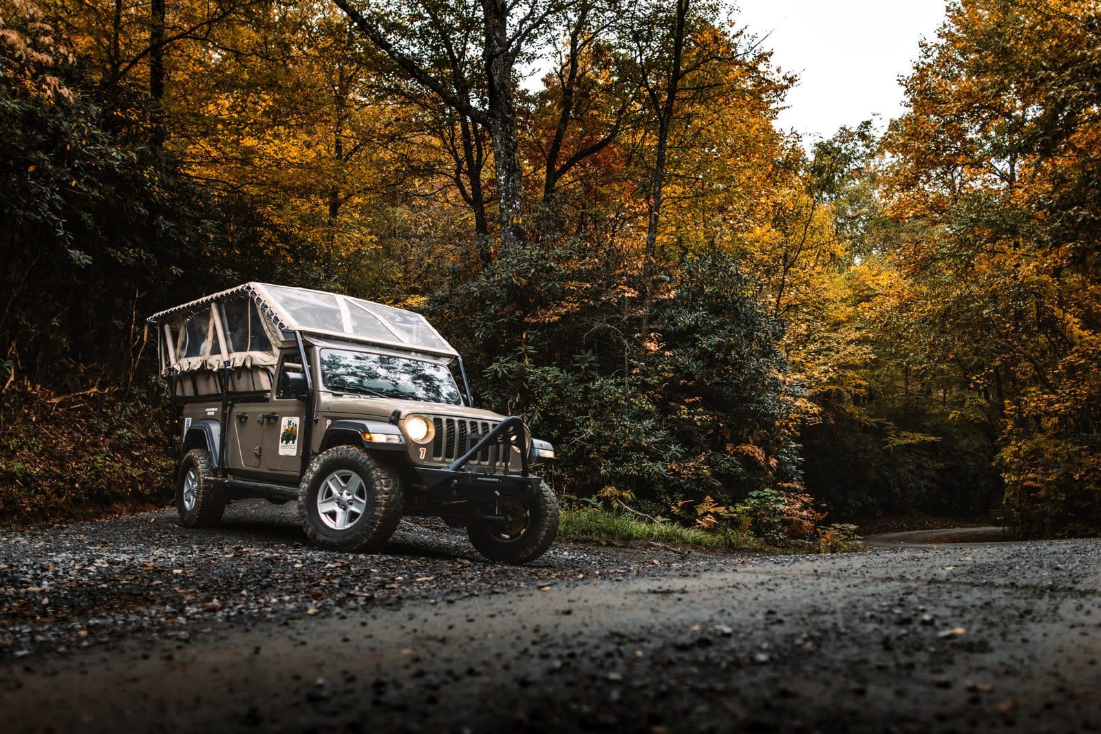
In other words: less “extreme sport,” more “hidden-road adventure.” That is the shape of our guided Off-Road Backroads Tour from Brevard.
Pisgah National Forest: The Backyard Playground
The heart of Asheville’s backroads scene is Pisgah National Forest, a half-million-plus acres of hardwood forest, waterfalls, whitewater rivers, and mountain peaks that ring the city to the north and south.
Within Pisgah, you’ll find:
- Gravel and clay Forest Service roads that climb to ridgelines and drop into shady coves
- Creekside tracks that follow tumbling mountain streams
- Connectors that bring you to trailheads, picnic spots, and scenic overlooks you’d never see from the highway
Some of these roads are smooth enough for most cars in dry weather; others really call for high-clearance vehicles—especially after rain, when ruts and washouts make things more interesting.
 Resources like off-road trail guides and apps list beginner-friendly routes near Asheville, including easy Forest Service roads around Bent Creek and Wash Creek FR 5000, which connects the Blue Ridge Parkway to the North Mills River area. These are typically rated “easy,” but still give that “I can’t believe we’re just a few miles from town” feeling.
What an Asheville Off-Road Backroads Route Feels Like
Picture this:
You leave Asheville on pavement, pass through a small mountain town, and then turn onto a narrow gravel road. Almost immediately, the world changes. Trees arch overhead; the air feels cooler and damp. You follow the road as it winds along a creek, past tiny waterfalls and moss-covered rocks.
Soon the road starts to climb. It switches from smooth gravel to a mix of rock, clay, and ruts. In a proper Jeep or high-clearance vehicle, it feels fun and secure—just bumpy enough to remind you that you’re off the beaten path.
Along the way, you might see:
- Old homestead relics: a chimney standing alone in the woods, a falling-down barn
- Wildlife: wild turkey, deer, maybe even a black bear in the distance
- View gaps: brief openings in the trees where you can glimpse long, hazy ridges in the distance
Eventually you pop out on a ridgetop or junction—maybe near the Blue Ridge Parkway, maybe deep in Pisgah—and you realize you’ve stitched together several miles of “locals-only” roads into a single, memorable adventure.
Backroads vs. Extreme Off-Road Parks
It’s worth being clear about what these routes are not. Asheville’s off-road backroads are not:
- Rock-crawling parks with obstacles built to break parts
- Cross-country riding where you leave the road and churn up the forest
- High-speed racing tracks
The U.S. Forest Service is very specific: motor vehicles must stay on designated roads and trails, and cross-country travel is prohibited. Visitors are expected to follow Motor Vehicle Use Maps that show exactly which roads are open to which kinds of vehicles and during what seasons.
So instead of tearing up the landscape, Asheville’s best backroad adventures stick to legal Forest Service roads, moving slowly enough to enjoy the scenery and share the space respectfully with hikers, cyclists, anglers, and campers.
When to Go: Seasons on the Backroads
The nice thing about these roads is that many are accessible year-round, though every season has its own personality:
- Spring: Fresh green leaves and high creeks; some muddy sections, but waterfalls and streams are at their best.
- Summer: Deep shade, lush ferns, and a noticeable temperature drop as you drive deeper into the forest.
- Fall: The showstopper. Gold, red, and orange leaves line the roads, and distant ridges glow in soft light.
- Winter: On open roads, leaf-off views suddenly appear, revealing valleys and peaks that are hidden the rest of the year.
Our season-by-season Asheville guide breaks down what each month looks like.
Weather and maintenance can temporarily close certain Forest Service roads, so it’s always smart to check current conditions before heading out—or let a local guide do that for you.
Why a Guided Off-Road Backroads Tour Is the Easy Button
Can you self-drive some of these roads? Sure—if you have the right vehicle, maps, and comfort level. But here’s my honest opinion: for most visitors, a guided Jeep-style tour is by far the best way to experience Asheville’s off-road backroads.
A good off-road tour company will:
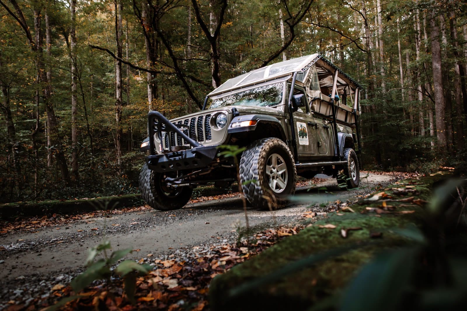
- Use purpose-built, high-clearance vehicles designed for gravel, clay, and rutted forest roads—comfortable yet capable.
- Choose routes that match the group’s sense of adventure without going beyond their comfort zone.
- Monitor closures, weather, and road conditions so you don’t show up to a locked gate.
- Build in stops at creeks, small waterfalls, scenic clearings, or old homesteads for photos and stories.
- Handle navigation, recovery gear, and safety so guests can just enjoy the ride.
From a guest’s perspective, you get all the fun of being way out there with none of the “are we lost / is this even legal / can my car make it back?” anxiety.
If you’re curious about what’s hiding just beyond the pavement, our Off-Road Backroads Adventures are the perfect way to taste Asheville’s wilder side—without giving up comfort or safety.
How big Pisgah National Forest actually is
The Forest Service puts Pisgah National Forest at over 500,000 acres across three ranger districts. The Pisgah Ranger District — the one you drive out of Brevard — is approximately 163,168 acres in Transylvania, Henderson, Buncombe and Haywood counties. Appalachian adds about 161,400, Grandfather another 193,385. Two wilderness areas sit inside the Pisgah district: Shining Rock, over 18,000 acres, designated September 1964, and Middle Prong, 7,900 acres of ridges the agency measures at 3,200 to over 6,400 feet. No vehicle enters either.

What a Forest Service road is — and where off-road driving is legal
A Forest Service road is a numbered public road inside the forest — FS 475, FS 1206, FS 97 — and the number is how the agency gates and tracks it. The Motor Vehicle Use Map decides what you may legally drive: “Routes not shown on the MVUM are not open to public motor vehicle travel.” It lists vehicle class and seasonal limits, not surface condition — hence the agency’s “Legal does not mean prudent.”
Leaving a designated road is prohibited under 36 CFR 261.13, and the Forest Service counts its off-highway vehicle areas exactly: “Within the National Forest of North Carolina, only four designated areas exist” — Brown Mountain (Grandfather Ranger District), Badin Recreation Area (Uwharrie), Black Swamp (Croatan) and Wayehutta (Nantahala). None is in the Pisgah Ranger District.
Gates, seasons and what Helene left behind
Pisgah’s forest roads are not uniformly open year-round. Lickstone Road (FS 97) closes to motor vehicles January 2 through September 1; the Ivestor Gap gate (FS 816) closes January 1 through August 15. On the Appalachian Ranger District a longer list closes January 1 through the first weekend in April, to protect wildlife habitat and cut road maintenance. The agency’s caveat: “Seasonal closure dates are liable to fluctuate depending on weather.”
Hurricane Helene struck in September 2024 and the repair is unfinished. In the district listing last updated June 11, 2026, Courthouse Creek Road (FS 140) and Pilot Mountain Road (FS 229) were closed by storm damage and Yellow Gap Road (FS 1206) was open only as far as Wolf Ford Horse Camp. A road absent from that list is not a road confirmed open — the agency publishes closures, not an open-road roster. A closed gate is closed to everyone, guided or not.

The forest that taught America forestry
Pisgah began as private land and became the template for public forestry. George Vanderbilt hired Gifford Pinchot, then Carl Schenck, who opened the Biltmore Forest School here — the Forest Service calls it “the first school of forestry in the United States.” After Vanderbilt died in 1914, Edith Vanderbilt sold 87,000 acres to the U.S. Forest Service and Pisgah National Forest was established in 1916. The site survives as the 6,500-acre Cradle of Forestry in the Pink Beds valley, created by Congress in 1968; it reopens the first Saturday in April. Bent Creek is not just a road name — the Bent Creek Experimental Forest dates to 1927 and is the oldest experimental forest in the East.

Common questions about driving in Pisgah National Forest
Where can you go off-roading in Pisgah National Forest?
True off-highway vehicle riding in Pisgah National Forest happens at the Brown Mountain OHV Area on the Grandfather Ranger District — the forest’s only designated OHV area. The Pisgah Ranger District nearest Brevard and Asheville has none. Driving there means street-legal vehicles on roads shown on the Motor Vehicle Use Map.
Can you drive through Pisgah National Forest?
Yes. Paved highways cross the Pisgah Ranger District, and the Forest Heritage National Scenic Byway is a 79-mile loop the Forest Service routes through the district and nearby countryside. Beyond the pavement, numbered gravel forest roads are open to street-legal vehicles unless seasonally gated or storm-damaged.
Can you drive off-road on National Forest land?
No. Travel off designated routes is prohibited under 36 CFR 261.13, and the Forest Service states that routes not shown on the Motor Vehicle Use Map are not open to public motor vehicle travel. “Off-road” driving in Pisgah means unpaved designated roads, not leaving the road surface.
Are there current road closures in Pisgah National Forest?
Yes. As of the Forest Service’s June 11, 2026 update, Courthouse Creek Road (FS 140) and Pilot Mountain Road (FS 229) were closed by storm damage, Turkey Pen Road (FS 297) had limited access and Yellow Gap Road (FS 1206) was open only partway. Closures change — check the district’s page first.
Why is part of Pisgah National Forest still closed?
Hurricane Helene hit in September 2024. Forest Service assessments found moderate-to-catastrophic damage across more than 190,000 acres, with 885 miles of roads severely impacted and 30% of roadbeds completely destroyed. Repair continues — the agency reported placing up to 2,000 tons of gravel a day, roughly 60 dump trucks.