


Updated August 26, 2026
If your camera roll needs a refresh, the Blue Ridge Parkway near Asheville delivers the most breathtaking photo ops in the region. This stretch of the Parkway is home to some of the most iconic—and Instagram-worthy—overlooks in all of North Carolina.
 Let’s start with Craggy Gardens Overlook, just 18 miles north of Asheville. On clear days, it offers layers of smoky blue mountains stretching endlessly. The adjacent Craggy Pinnacle Trail is a short but steep hike to even more commanding views.
Heading south from Asheville, Mount Pisgah Overlook is another must-see. Its elevation and western-facing angle make it a dreamy sunset destination. Looking Glass Rock Overlook dazzles with views of the massive rock face that glistens after rain. Both overlooks sit on the stretch our Blue Ridge Parkway tour from Brevard drives.
 And don’t skip the Folk Art Center Overlook, where art, culture, and nature combine beautifully. It’s an ideal spot for those who want a quick taste of the Parkway with easy access.
When you book a Jeep tour with AshevilleToursAndExcursions.com, our guides make sure you hit the best spots at the perfect time of day. No guesswork. Just awe.
How Parkway mileposts work, and where Asheville sits on them
Every overlook on the Blue Ridge Parkway is found by its milepost. The road runs 469 miles from Rockfish Gap, Virginia south to Cherokee, North Carolina, with mileposts starting at 0 in Virginia and counting upward as you drive south — so Blue Ridge Parkway overlooks in Virginia carry low numbers and the North Carolina ones carry high numbers.
Asheville sits between Milepost 382 and Milepost 393.6. The National Park Service lists the city’s gates as the Folk Art Center (MP 381.9), Highway 70 (MP 382.8), Park Headquarters and Visitor Center (MP 384.1), Highway 74 (MP 384.7), Highway 25 (MP 388.8) and NC Route 191 (MP 393.6). So on any Blue Ridge Parkway map with overlooks marked: below 382 is north of the city, above 393 is south.

North of Asheville or south? The choice that shapes your drive
You cannot do both directions well in one outing, so pick a side before you leave.
Heading north — lower mileposts, and the overlook that shows you the city
The Blue Ridge Parkway Visitor Center at Milepost 384 is the only visitor center on the whole 469-mile road open year round. But the overlook to know up here is Haw Creek Valley Overlook at Milepost 380 — the rare pull-off whose view takes in the town itself. The Park Service calls it “a short drive north from Asheville, but feels miles away,” with a valley view of “the Haw Creek Valley community and major Asheville buildings.”
From the wall you can name Ducker Mountain, Chestnut Top, Ball Mountain, Double Head, Little Bald Mountain, Mount Pisgah, Scott Mountain and Piney Mountain. Listed amenities are auto parking and the viewpoint — nothing more. Further north sit the high balds at Milepost 364, then at Milepost 355.3 the access to Mount Mitchell, at 6,684 feet the highest point east of the Mississippi.

Heading south — higher mileposts, higher ground
South of the city the road climbs onto the Pisgah Ledge and stays high, which is why most of the best overlooks on the Blue Ridge Parkway in this region carry southern mileposts. In driving order: Mills River Overlook (MP 404.5); Mount Pisgah (MP 408), where the Pisgah Inn is the Parkway’s highest lodging at over 5,000 feet; Cold Mountain Overlook (MP 411.9), west-facing, at the Highway 276 crossing; and Pounding Mill Overlook (MP 413.2) at 4,700 feet, with long-range views in three directions — NPS places it “approximately 1 hour south of Asheville.”
Beyond that, Graveyard Fields (MP 418.8) is a mile-high valley with a 1.2-mile loop, two waterfalls and — unusually out here — accessible restrooms. Three miles on, Devils Courthouse (MP 422) rises to 5,720 feet, peregrine falcons nesting on its rock face and, on a clear day, views into four states. If waterfalls are the real draw, our guided waterfall trips work the lower country below this stretch.
Mills River Overlook, Milepost 404.5 — the one that opens on both sides
Most Parkway pull-offs give you one direction. This one does not: “While most overlooks on the Blue Ridge Parkway open the view on one side, the Mills River Overlook allows visitors to see the bigger picture,” with “clear views into the valleys on either edge.”
It is also the most precisely timed drive on this page — NPS gives approximately 35 to 40 minutes from Asheville. There is auto parking, a Mountains-to-Sea Trail trailhead, and a paved overlook with a level sidewalk.
Its thin tree cover also makes it a hawk-watching destination. Migrating raptors ride thermals to gain altitude heading south, and NPS names the last two weeks of September and the first week of October as the window. Come mid-morning through mid- to late afternoon rather than at dawn — the thermals need the day to warm first.

When to go: elevation moves the fall-color calendar
The most useful thing to understand about timing here is that altitude, not the calendar, decides when the leaves turn. Appalachian State University’s fall-color map gives the rule: “for each 1,000′ increase in elevation, peak fall colors would occur about one week earlier.” Dr Howard Neufeld sets the anchor — peak arrives “around mid-October at elevations between 2,500 and 4,000 feet; earlier for higher elevations and later for lower ones.”
So the high southern overlooks — Devils Courthouse and Graveyard Fields, both above 5,000 feet — are likely turning while the valleys around Asheville are still green, and the common advice that “peak is late October” describes lower ground than most of these overlooks stand on. That is arithmetic on two sources rather than a published range, so check close to your date: a warm end to September can push peak back three or four days, sometimes two weeks.
Autumn is not the only season worth the drive: monarchs cross the high meadows at Cherry Cove Overlook (MP 417) in September and October.


Is the Parkway open near Asheville right now?
Check this hardest, because Hurricane Helene changed the answer and much of the guidance published since has gone stale. Helene made landfall in September 2024 and dropped up to 30 inches of localized rain along the Parkway, triggering at least 57 landslides across nearly 200 miles of the road in North Carolina.
Recovery has been phased. NPS reopened a 26-mile section north from Asheville on September 15, 2025, after landslide repairs around MP 375–380, and said in March 2026 that work between Mount Mitchell and Little Switzerland should finish by late 2026.
As of the NPS road table timestamped 6:40 A.M. on Tuesday, August 25, 2026, every gated segment from Milepost 355.3 to Milepost 443.0 is listed Open — covering every overlook named here, in both directions. One exception stands: the Craggy Gardens Picnic Area is still closed under a Helene-related closure, though the road past it is open.
Do not treat that as a promise for your travel day. NPS attaches its own warning — “Status is subject to change throughout the day after the page has been updated” — and snow, ice, fog and rockslides shut sections at short notice year round. Check it the morning you go.
What the pull-offs have — and what they don’t
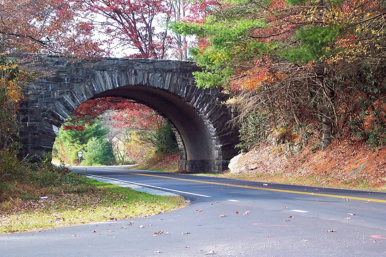
Overlooks here are paved pull-offs set directly off the travel lane, and most offer parking and a view and nothing else; only a handful — Graveyard Fields, the visitor centers — add restrooms. The speed limit is mostly 45 mph, dropping to 25 or 35, and the road is built with what NPS calls decreasing-radius curves, “a design feature of the parkway that requires some extra care.” There are 26 tunnels, most south of Asheville.
There are no gas stations on the Parkway and no EV charging on it, so fill up in town first. NPS is blunt about connectivity too: “Do not rely on technology, as cell phones do not work in many locations along the Parkway and GPS is sometimes unreliable.” Navigate by the mileposts — and there is plenty else worth building a day around back down in town.

Common questions about Blue Ridge Parkway overlooks near Asheville
What are the best Blue Ridge Parkway overlooks near Asheville?
Going south: Mills River Overlook (MP 404.5), Cold Mountain Overlook (MP 411.9), Pounding Mill Overlook (MP 413.2) and Devils Courthouse (MP 422), which reaches 5,720 feet and sees four states on a clear day. Going north: Haw Creek Valley Overlook (MP 380), whose view includes the city itself.
Where do you get on the Blue Ridge Parkway in Asheville, NC?
The Park Service lists six access points around the city: the Folk Art Center at MP 381.9, Highway 70 at MP 382.8, Park Headquarters and the Visitor Center at MP 384.1, Highway 74 at MP 384.7, Highway 25 at MP 388.8, and NC Route 191 at MP 393.6.
Is the Blue Ridge Parkway still closed near Asheville?
No. As of the NPS road table timestamped 6:40 A.M. on August 25, 2026, every gated segment from MP 355.3 to MP 443.0 is open, in both directions from the city. Sections north of Mount Mitchell are still under repair, with completion expected late 2026.
Where can I find the best view of the Asheville skyline?
Haw Creek Valley Overlook at Milepost 380 is the Parkway pull-off the Park Service describes as showing “the Haw Creek Valley community and major Asheville buildings.” Most other overlooks near the city face away from town into the mountains, which is largely the point of where the road was routed.
What is the most photographed place on the Blue Ridge Parkway?
No official source publishes a ranking, and any page naming one is guessing. What is documented is which overlooks the Park Service singles out for their views: Pounding Mill for long range in three directions, Mills River for opening on both sides at once, and Devils Courthouse for its four-state horizon.
Is there a scenic drive on the Blue Ridge Parkway from Asheville?
The whole road is the scenic drive — it was built as a destination rather than a route. From the city you reach Haw Creek Valley Overlook within a couple of mileposts, or Pounding Mill Overlook in roughly an hour heading south. Both directions are currently open end to end.


